
 Kontakt
 Kako kupovati
Dostava
Savjetnik za kupnju
Hadrian's Wall
 Engleski
 44 b
44 b
Do 30 dana za povrat
Moglo bi vas zanimati i




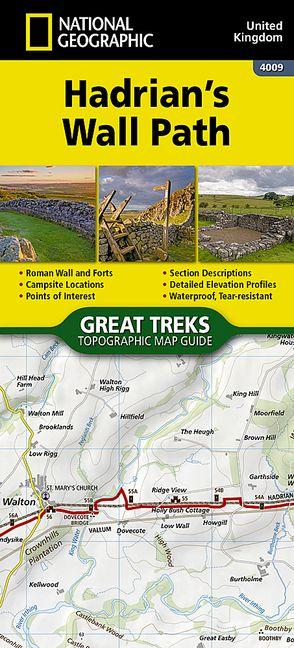
Waterproof Tear-Resistant Topographic Map
As a demonstration of the Roman Empire''s power and strength, Emperor Hadrian conceived the idea to build a wall to deter attacks on his Roman territory Britannia. At the time and even today building a 73-mile (118-kilometer) long wall, standing 5 meters (16 feet) high and 3 meters (10 feet) wide was an exceptional undertaking. In a.d. 122, approximately 15,000 soldiers were enlisted to begin construction of this project, which included forts, turrets, bridges, milecastles, and the interconnecting wall.
Today, Hadrian''s Wall is recognized as a UNESCO World Heritage Site. From Bowness-on-Solway to Wallsend, the 84-mile (135-kilometer) Hadrian''s Wall Path meanders the wild and scenic English countryside providing an opportunity to learn more about these historic sites.
The Hadrian''s Wall Path Topographic Map Guide booklet makes a perfect traveling companion when traversing the route. A detailed description of each trail section is included that tells travelers about the many landmarks encountered along the way.
Every Great Treks map is printed on "Backcountry Tough" waterproof, tear-resistant paper. A full Lat/Long grid is printed on the map to aid with GPS navigation. Every map purchase helps support the National Geographic Society, an impact driven, nonprofit organization with global reach that uses the power of science, exploration, education, and storytelling to illuminate and protect the wonder of our world.


Informacije o knjizi
Engleski
Kategorija

Poklonite ovu knjigu još danas
To je jednostavno
1 Dodajte knjigu u košaricu i odaberite isporuku kao poklon 2 Zauzvrat ćemo vam poslati kupon 3 Knjiga dolazi na adresu poklonoprimcaDobar dan! Ja sam Libroamiko, vaš književni savjetnik.
Kako vam mogu pomoći?